
King County ZIP Coverage
The KCGIS ZIP layer contains polygons for six counties, so the COUNTY_NAME field must be filtered to King County. The full filtered result is below. “Preferred city” is the KCGIS postal label, not proof that the whole ZIP lies in that municipality. The post-office column therefore reports a label, not a branch location.
| ZIP | King County area | Postal label | KCGIS note |
|---|---|---|---|
| 98001, 98002, 98092 | South King County polygons | Auburn | Standard |
| 98003, 98023 | Federal Way area polygons | Federal Way | Standard |
| 98004, 98005, 98006, 98007, 98008 | Bellevue area polygons | Bellevue | Standard |
| 98010 | Black Diamond area polygon | Black Diamond | Standard |
| 98011 | King County polygon | Bothell | Standard |
| 98014 | Carnation area polygon | Carnation | Standard |
| 98019 | Duvall area polygon | Duvall | Standard |
| 98022 | Enumclaw area polygon | Enumclaw | Standard |
| 98024 | Fall City area polygon | Fall City | Standard |
| 98027, 98029 | Issaquah area polygons | Issaquah | Standard |
| 98028 | Kenmore area polygon | Kenmore | Standard |
| 98030, 98031, 98032, 98042 | Kent area polygons | Kent | Standard |
| 98033, 98034 | Kirkland area polygons | Kirkland | Standard |
| 98038 | Maple Valley area polygon | Maple Valley | Standard |
| 98039 | Medina area polygon | Medina | Standard |
| 98040 | Mercer Island polygon | Mercer Island | Standard |
| 98045 | North Bend area polygon | North Bend | Standard |
| 98047 | King County polygon | Pacific | Standard |
| 98050 | King County polygon | Preston | PO Box-type label |
| 98051 | Ravensdale area polygon | Ravensdale | Standard |
| 98052, 98053 | Redmond area polygons | Redmond | Standard |
| 98055, 98056, 98057, 98058, 98059 | Renton area polygons | Renton | Standard |
| 98065 | Snoqualmie area polygon | Snoqualmie | Standard |
| 98068 | Mountain-area county polygon | Snoqualmie Pass | PO Box-type label |
| 98070 | Vashon Island polygon | Vashon | Standard |
| 98072, 98077 | Woodinville area polygons | Woodinville | Standard |
| 98074, 98075 | Sammamish area polygons | Sammamish | Standard |
| 98101, 98102, 98103, 98104, 98105, 98106, 98107, 98108, 98109 | Seattle-area polygons | Seattle | Standard |
| 98112, 98115, 98116, 98117, 98118, 98119 | Seattle-area polygons | Seattle | Standard |
| 98121, 98122, 98125, 98126, 98133, 98134, 98136 | Seattle-area polygons | Seattle | Standard |
| 98144, 98146, 98148, 98154, 98155, 98158, 98164 | Seattle-area polygons | Seattle | Standard |
| 98166, 98168, 98177, 98178, 98188, 98195, 98198, 98199 | Seattle-area polygons | Seattle | Standard |
| 98224 | King County polygon portion | Baring | PO Box-type label |
| 98288 | King County polygon portion | Skykomish | PO Box-type label |
| 98354 | King County polygon portion | Milton | Standard |
| 98422 | King County polygon portion | Tacoma | Standard |
The layer query did not independently verify 98009, so it is not added. Codes associated with Baring, Skykomish, Milton, and Tacoma represent King County polygon portions. They do not mean that every delivery address under those labels lies in King County. Preston and Snoqualmie Pass carry PO Box-type labels in the data. Run the exact street address through USPS before mailing or publishing a ZIP.
Filter the King County ZIP Layer
KCGIS reports 273 features across its six-county layer, last updated May 1, 2024 in the catalog cited by the research. A county filter prevents nearby polygons from being mistaken for King County coverage. The result fields also keep postal and civic geography separate.
| Field | Control | Required | Use |
|---|---|---|---|
| ZIP / ZIPCODE | Text or query | No | Filter one five-digit code |
| COUNTY_NAME | Filter | No | Choose King County |
| PREFERRED_CITY | Result | No | Read the postal city label |
| ZIP_TYPE | Result | No | Distinguish standard and PO Box-type data |
| Geometry | Map or GeoJSON | No | Inspect the polygon shape |
| USPS street, city, state | Form fields | Conditional | Validate an exact mailing address |
The KCGIS administrative ZIP service exposes the polygon fields used for this directory.
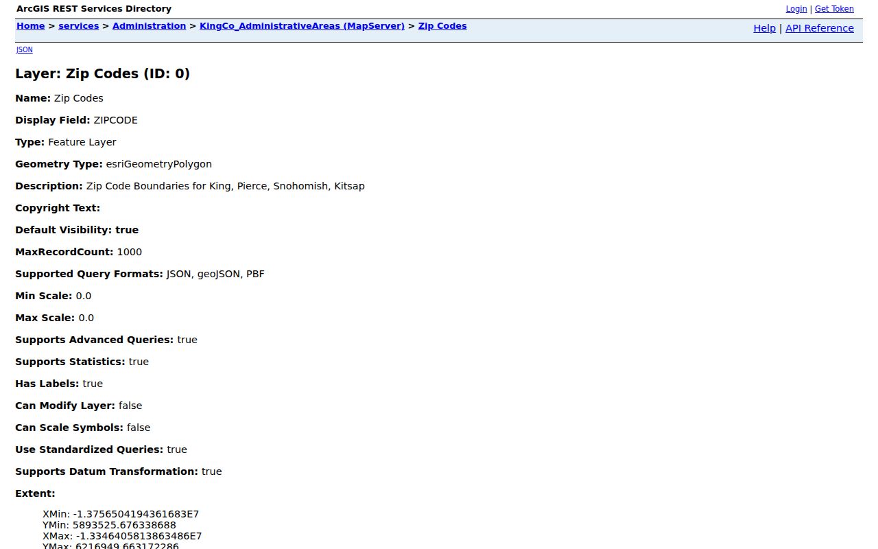
Read ZIP, county, type, preferred city, and geometry together before drawing a boundary conclusion.
Search King County by ZIP
No verified public King County portal accepts a ZIP code and returns a legal list of residents. A ZIP code directory can narrow an area, then official parcel tools can identify individual properties. That distinction prevents a postal polygon from being treated as an occupancy roll.
- Filter the KCGIS polygon service by COUNTY_NAME and the five-digit ZIP. Save its preferred-city and type fields.
- Use Parcel Viewer or iMap to inspect parcels and address points within the relevant part of the polygon.
- Open the Assessor record for a selected parcel. Keep the physical or situs address separate from the owner's mailing address.
- Validate the exact street address with the USPS lookup. A USPS result confirms mailing format, not a person or company at that address.
Voter data is controlled by its own state rules and request process; the public individual lookup is not a ZIP-wide people list. If a ZIP has narrowed the research to one road, the King County street directory carries the work to address and parcel level.
Verify King County ZIP Addresses
The USPS ZIP Code Lookup supports a street-address route with city and state, plus a city-and-state route. Use the exact-address option after viewing the broader KCGIS polygon. USPS expressly warns that a result does not confirm that a person or company is at the address.
The USPS lookup screen is the final postal check for a King County address.
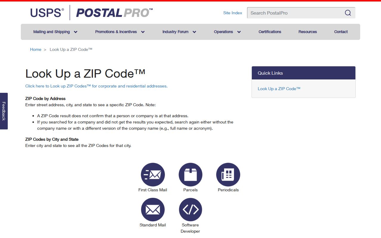
Carry the verified ZIP and preferred city forward as mailing facts only, while the parcel map supplies county geometry and local jurisdiction.
King County ZIP Corrections
KCGIS records two useful corrections dated June 24, 2024. A 19000 block of SE 320th Street moved from Auburn 98092 to Kent 98042. The code for 3205 C Street NE changed from 98001 to 98002. These details show why a copied ZIP table needs a source date and why an exact address should be checked again.
Boundary and jurisdiction files can change on different clocks. KCGIS also lists September 23, 2025 revisions for Enumclaw and Snoqualmie right-of-way areas, plus five Duvall Big Rock Park parcels with an annexation effective January 1, 2026. Those are civic-boundary records, not automatic postal changes, but they may change which city or county office holds a permit record.
Note: Keep the GIS layer date beside every saved polygon, especially when an address sits near a city or county edge.
ZIPs and King County Communities
King County's seven Community Service Areas provide another layer for unincorporated places: Bear Creek/Sammamish, Four Creeks/Tiger Mountain, Greater Maple Valley/Cedar River, Snoqualmie Valley/Northeast King County, Southeast King County, Vashon/Maury Island, and West King County. White Center is a West King County example, while Skyway and Fairwood are well-known community names that are not incorporated cities.
A community label can help choose local sources, but it should not replace a parcel jurisdiction check. One address may carry a USPS preferred city, KCGIS county polygon, municipal boundary, parcel tax record, and Community Service Area label. Record each field separately.
King County ZIPs Versus Cities
A ZIP is postal geography. It can cross a city or county boundary, and its preferred city can be a mailing label rather than the parcel's municipality. This is why the King County ZIP code directory lists county polygon portions for Baring, Skykomish, Milton, and Tacoma instead of claiming full delivery areas. For permit or code records, verify whether the parcel is inside a city or unincorporated King County.
- ZIP code
- A five-digit postal sorting area. It is not a resident count or a city boundary.
- ZIP+4
- A five-digit ZIP plus four more digits that narrow a delivery segment.
- PO Box-type ZIP
- A KCGIS classification tied to post-office-box service rather than a normal street-delivery area.
- Unique ZIP
- A code assigned for a single large receiver or institution. No unique King County row was independently documented in the filtered table.
- Carrier route
- A postal delivery path within a ZIP, not a municipal district or proof of occupancy.
Historical addresses need another method because ZIP codes postdate nineteenth-century city directories and many annexations. Search the old street name and former house number, then use maps and municipal records. Do not assign a modern ZIP to an old entry without contemporary postal evidence.